


PhotoGeoTag app for iPhone and iPad
Developer: Digipax S.r.l.
First release : 10 May 2011
App size: 972.96 Kb
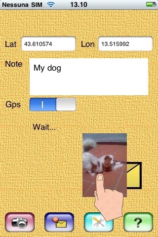
With this application you can take pictures, inserting into them the geographical location data, and you can send them via email.
The Exif data obtained from the GPS receiver, can be incorporated into the photos, along with a brief note.
If you know the coordinates, not having the GPS receiver, you can also write by hand the geographical data. Once photos have been geotagged, they can be sent to a specialized server (eg. flickr.com,picasa.google.com, panoramio.com).
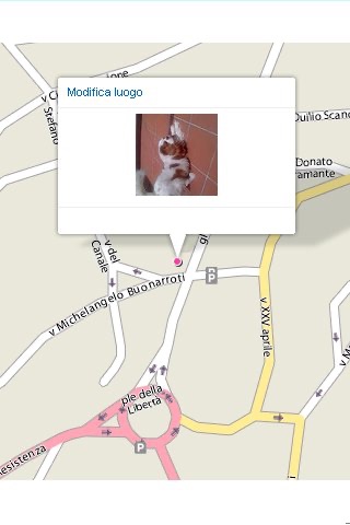
These sites are able to recognize geotagged photos and place them on the map automatically, without manual operations.
You can keep memories of the best places encountered on a trip - in real time - so your friends will enjoy with you the most exciting moments.
The program is very useful also from the professional point of view.
On many occasions it is useful to record the geographical position linked with an image (eg. real estate sales, technical inspections, accident, etc.).
Use the settings section, to preset some data, especially the email destination (your private address or the one issued by the specialized servers such as Panoramio, Flickr, Picasa etc…).
To sending the email, use the drag and drop dragging the photo on the envelope.